Introduction to today's journey
Brisbane City straddles the Australian eastern coast's largest river, meandering through leafy suburbia against a backdrop of forested hills. Brisbane's unique geographical setting gives close proximity to vast areas of lush wilderness. Sealed walkways through parkland following the flood prone streams flowing into the river provide a forested corridor from the city centre to the base of the ranges.
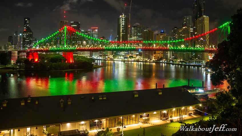
Today's journey starts at the scenic Wilson's Point overlooking Brisbane City, a fitting start to the northern loop of the South East Queensland Trek. I hike through the city centre before following Enoggera Creek upstream to its source at the Enoggera Reservior.
Distance hiked today: 28.7km
Total distance hiked: 28.7km
Today's Journey
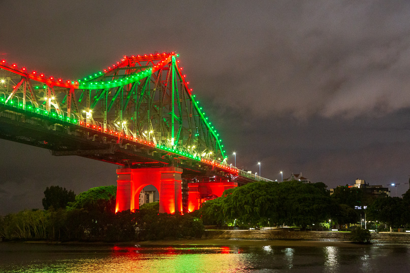 |
Setting off from Wilson Point on this hiking odyssey, I follow the trail beneath the iconic Storey Bridge starting an epic journey through South East Queensland. Rain falls from the low hanging clouds on this humid New Year's morning. |
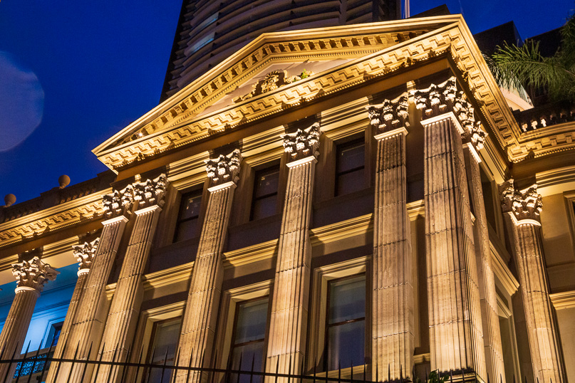 |
Here in this urban jungle the colossal towers rise to almost touch the cloud cover. Amongst these towers is the relatively diminuitive Customs House. Standing as a stubborn relic to early European Settlement when settlers arrive from many months at sea from afar. The customs house is now a riverside restaurant in this now bustling city. |
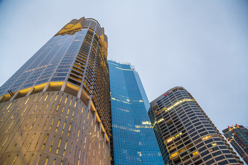 |
As I stroll beside the river, the skyline quickly transforms from apartments to the ultra-modern glass towers of Brisbane's financial district. There are a lot less lights on than usual due to today being New Years day in the middle of the annual holidays. Even the city lights need a break after a wild night of partying bringing in the new year. |
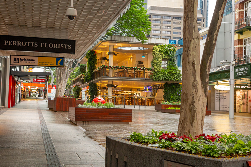 |
Upon reaching the Gardens Point Botanical Gardens, I leave the river navigating the city jungle into Queen Street Mall. The mall is the city centre's backbone, tracing the footsteps of those early European settlers who built the city from a jungle path into a major commercial centre. Two centuries later, here I am on a different kind of expedition hiking the concrete jungle on the start of an epic trek into the wilderness of South East Queensland. |
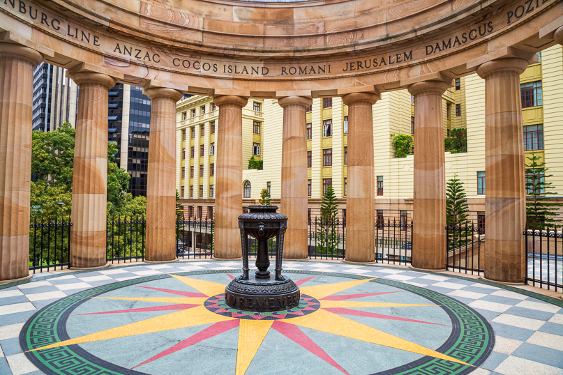 |
From Queen Street Mall, I head to the nearby Post Office Square, passing through to reach ANZAC Park. Here in this well-manicured park stands numerous life-sized bronze statues of the heroes of wars past. After exploring the park I head up to the stone pavilion at the end where the eternal flame burns honouring those who bravely faced the wars. |
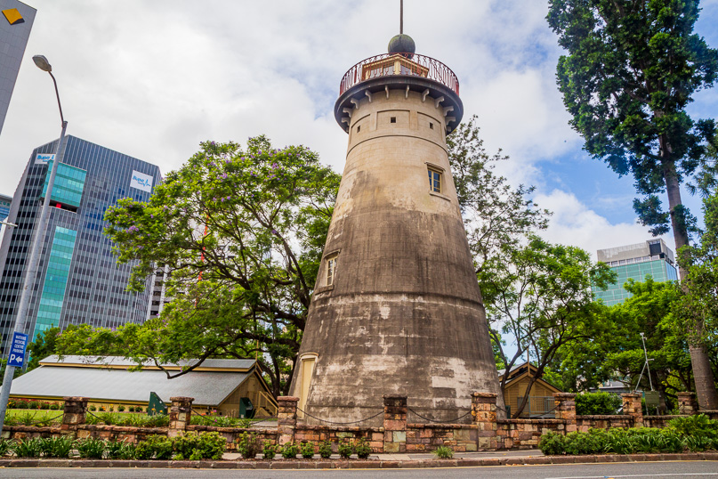 |
Scaling the city's hilly terrain above Central Station, I climb Jacob's Ladder and stumble upon the Old Windmill Observatory, Brisbane's oldest building constructed by convicts in 1828 as a grain store. It was later converted into a ship signalling tower and a timeball was installed in 1851. It is now a museum and now sits hidden beneath countless glass high rise towers with not a glimpse of the river. |
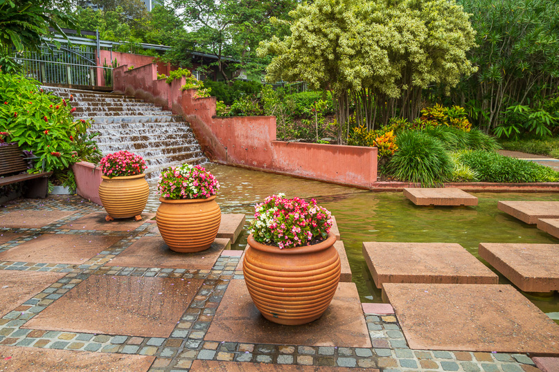 |
A little downhill from the windmill, I find myself in Roma Street Parkland. Once an Aboriginal meeting hub for millennia, it became part of the Brisbane settlement in the nineteenth century and eventually became part of the railways yards before being converted to parkland in 1995. Beautifully landscaped, it marks a very pretty transition from the central city to the start of the city suburbia I will be going through over the remainder of the day. |
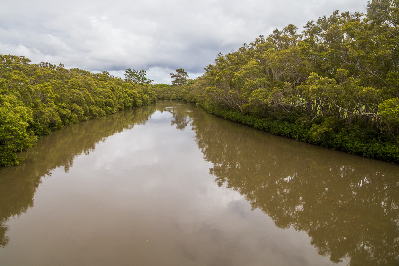 |
From the parklands I meander along the sealed pathway through Victoria Park and through some suburbia of old Queenslander houses descending to Enoggera Creek where I cross its mangrove lined muddy river over a long footbridge. A sealed track leads upstream from here for the remainder of today's hike, leading to a walking track continuing upstream towards its source where I will be heading tomorrow. |
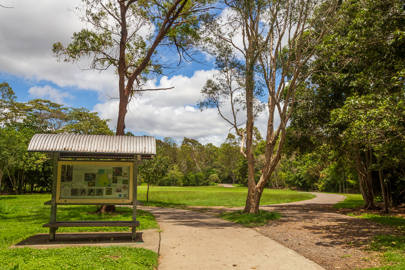 |
Nearly all the path following Enoggera Creek passes through parkland where locals go on their brisk morning walks between the rain showers. Brisbane is prone to some epic rainfall and flooding, so most of the waterways have parkland on either side with the houses up the hills on either side to escape the flooding. Pathways weave effortlessly through these parklands making the hike upstream a breeze. I continue following Enoggera Creek upstream stopping at one of the larger parks, the Banks Street Reserve, for lunch. |
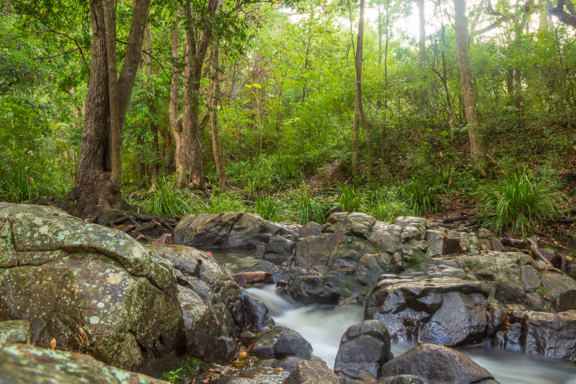 |
Hiking upstream along the park trails, I pass several suburbs heading further out from the city, eventually reaching The Gap, a suburb sandwiched snugly between Enoggera Hill and Mount Coot-tha. Here the creek cascades down cascades over rocky sections, creating a natural water symphony. The rain clears with the clouds starting to break up as the surrounding landscape hints I'm gradually approaching the end of civilisation. |
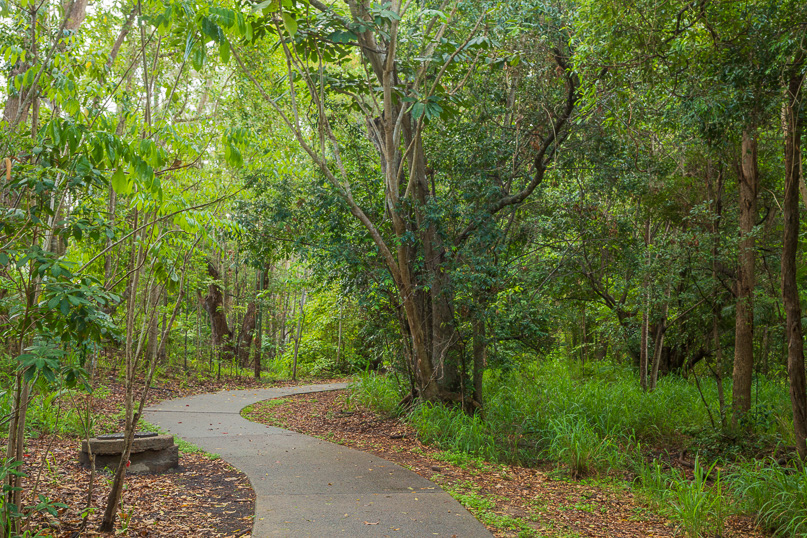 |
The concrete trail curves through lush greenery like a snake on a mission. I am now warmed up striding confidently along this paved masterpiece above the creek now approaching the dam, dodging the occasional jogger on a much shorter and faster journey than me. |
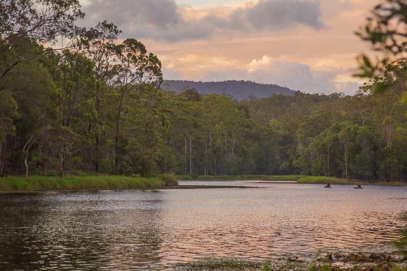 |
The trail suddenly turns to cross under the Enoggera Dam to a short climb up to the lake passing under the Walkabout Creek Wildlife Centre. I reach the edge of the lake in time to watch the sunset show. Whilst still present, the clouds have parted enough to create a spectacular palette of colour to make up for this morning's grey city sunrise. |
|