Introduction to today's journey
Today's journey starts from Rainbow Beach village following the narrow beach between the pristine water and the towering cliffs of Coloured Sands cut through the Cooloola Sandmass, the world's oldest sand formation. Upon reaching the end of the beach I climb a small volcanic hill to the Double Island Point lighthouse before heading down the northern end of Teewah Beach to the Freshwater camping ground.
Distance hiked today: 24.4km
Total distance hiked: 628.5km
Today's Journey
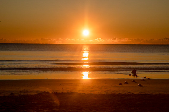 |
The sun rises over Rainbow Beach as I start the coastal section heading southwards towards Brisbane. |
 |
After leaving the village, I reach Mudlo Rocks which makes the beach beyond inaccessible to vehicles on any tide, but easy to walk around the boulders when the tide is low. |
 |
The sand cliffs quickly increase in height over the following half hour before I pass under Carlo Sandblow. The steep cliffs of hardened sand have channels of soft sand blown from the sand blow running down their front. |
 |
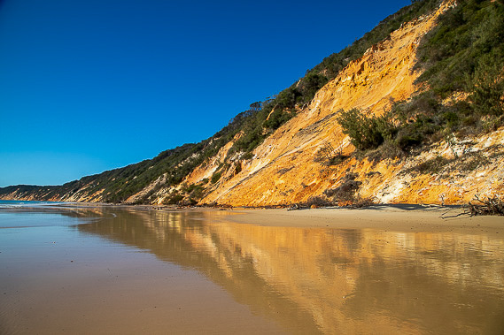
From Carlo Sandblow, the beach stretches out another seven kilometres passing the spectacular sand hills of the Coloured Sands. Here the ocean has sliced through the thickness of the Cooloola Sandmass revealing some of the oldest sand deposits in the world, some up to a million years old. |
 |
I reach Middle Rocks about half way along the beach. Here I rest looking along the sand cliffs towards Double Island Point where I will be reaching later today. |
 |
Setting off from Middle Rocks, the cliffs become even more dramatic and brightly coloured thanks to the erosion caused by the flooding rains of earlier this year. Water gushes out of underground channels having seeped through the sandmass.
|
 |
Eventually I reach the end of the cliffs and follow the forested hills passing a couple of lagoons as the hills of Double Island Point get closer. |
 |
The beach suddenly ends at a track leading through scrubby forest to the lighthouse at the top of Double Island Point Hill, where I relax for a late lunch. |
 |
From the hill I descend to the top of Teewah Beach which stretches a huge distance down to Noosa, invisible from sea level. This beach is very busy with four wheel drive traffic and the high tide makes the ten kilometre trek along this section of beach slow and difficult. |
 |
Eventually I reach the track heading towards Freshwater Camping Ground. Eight hundred metres of hiking inland into the sandmass brings me to the camping ground where I set up the tent for the night. |
|
