Introduction to today's journey
Hidden within the lush embrace of the ancient rainforest atop the scenic range, the village of Mount Glorious emerges as a hidden oasis, inviting travellers to immerse themselves in the mystical beauty of the rainforest. Mount Glorious, aptly named, reveals itself as a haven for those seeking refuge from the everyday hustle into a sensory journey to the heart of nature's embrace. The pervasive mist is thick with the earthy aroma of damp foliage, carrying the melodies of bird calls serenading your journey into the enchantment of this rainforest haven.
Today's journey departs Dundas Road Camp descending deep into the vallay crossing England Creek before starting the long climb up Joyner's Ridge to Mount Glorious. Here I explore the Maiala rainforest trails to Greene's Falls before heading to nearby Northbook Mountain to camp.
Distance hiked today: 26.6km
Total distance hiked: 105.7km
Today's Journey
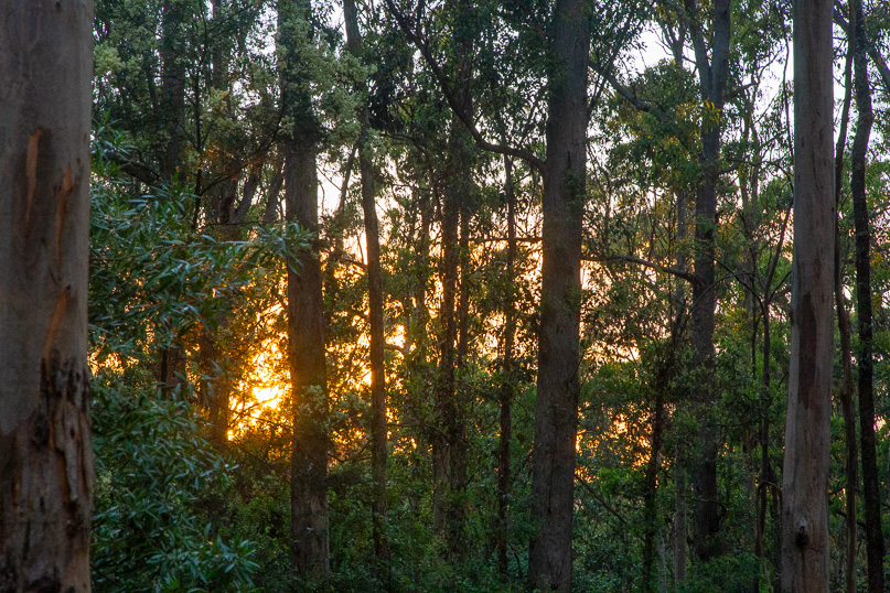 |
As the first light of dawn paints the sky with hues of pink and gold, I set off from the Dundas Road Bush Camp on day four of this trek. I follow Goodes Road track, gently winding its way down the ridge under the towering eucalypt trees. The track meanders for a few kilometres before veering westward towards the lower reaches of Brisbane Valley, near the tranquil Wivenhoe Dam. I leave this track to follow Side Break, descending a little too steep for my liking, plunging nearly three hundred metres into the deep valley below.
|
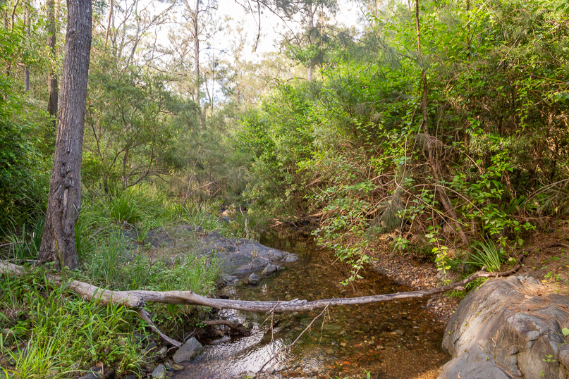 |
Reaching the bottom of the valley, I cross England Creek, its waters glistening under the morning sun. Upon reaching the other side, the track abruptly ends at the junction of the England Creek Road dirt track, which I follow moderately gaining 120 metres elevation. As I reach the top of a low saddle near the bottom of Joyner's Ridge, where I rest. |
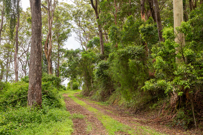 |
From the saddle, I follow Joyner’s Ridge Road, steadily climbing the ridge. The path is taking me through a dense eucalypt forest, the scent of eucalyptus filling the air as I pace myself with a four hundred metre ascent to Mount Glorious, at the top of the range. |
 |
As I approach the top of the ridge, the landscape begins to transform dramatically. The towering eucalypt trees give way to a dense, lush rainforest, the air growing cooler and more humid with each step. The familiar ringing of the bellbirds fades, replaced by the melodic warbles of rainforest pigeons echoing through the canopy. The undergrowth becomes thicker and more vibrant, teeming with life. I catch glimpses of small bush wallabies, their eyes peering curiously from the shadows of the dense foliage.
|
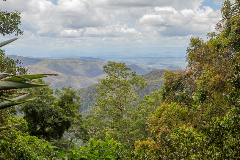 |
After a hairpin bend, and another ten minutes of climb, I reach the narrow Western Window walking track. The path is winding and intimate, leading me to a junction where a steep stairway of moss-covered rocks beckons. Carefully, I ascend this natural staircase, each step bringing me closer to the Western Window lookout. Looking beyond Joyner's Ridge which I have just climbed, the dense forest continues, eventually giving way to the expansive farmlands of the Brisbane Valley. In the far distance, the long ridge of the Great Dividing Range separates the lush east coast from the vast Australian outback extending over four thousand kilometres to the west coast.
|
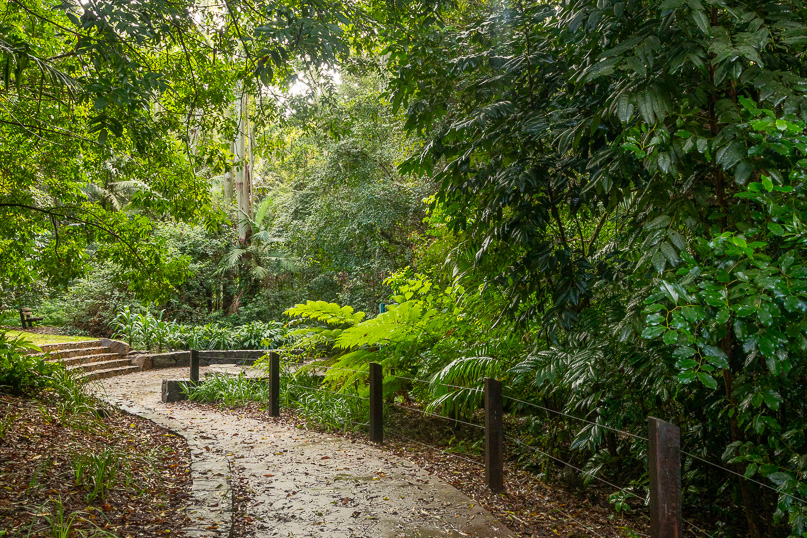 |
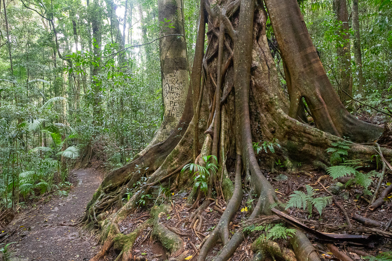
From Western Window, a short walk through the forest leads to the top of the 680-metre-high Mount Glorious Ridge. The road following the top of the ridge comes from Mount Nebo village and continues to Northbrook Creek which I will be crossing tomorrow. Upon crossing the road, I descend into the Maiala day use area. “Maiala,” means “quiet place” in the local Aboriginal language. It is certainly living up to its name here, being a serene haven, surrounded by towering rainforest trees and the gentle sounds of nature.
|
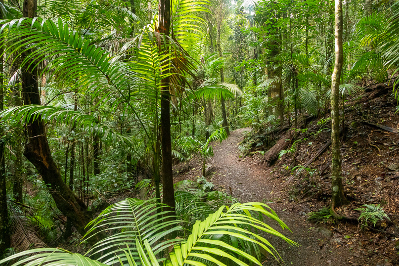 |
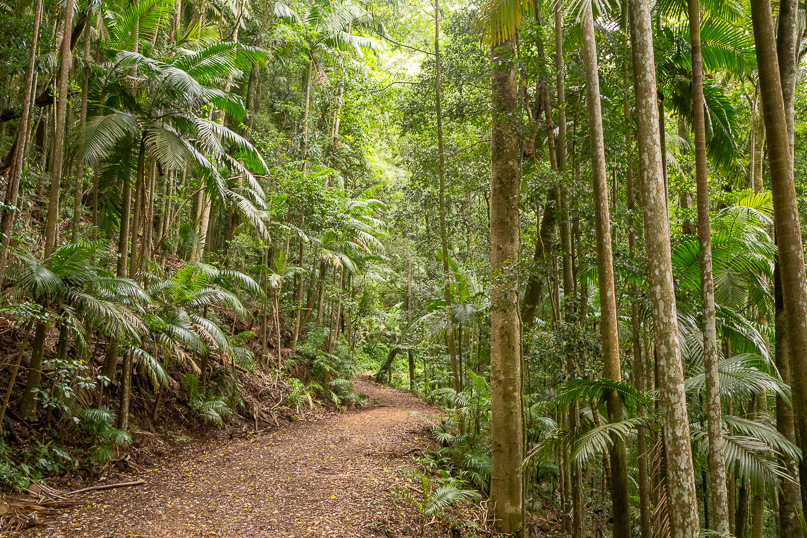
From the Maiala day use area, I set off along the start of the Rainforest Circuit, the path winding through a verdant wonderland. The track soon begins to descend, leading me down the hill towards Greene’s Falls. As I follow the sheltered gullies, I am surrounded by some of Queensland’s most lush and pristine rainforest. Giant trees tower above, their branches forming a dense canopy that filters the sunlight into a soft, green glow. The undergrowth is a vibrant tapestry of lush palm trees and broadleaf shrubs, each plant adding to the rich diversity of this incredible ecosystem. The air is filled with the earthy scent of damp foliage and the distant sound of cascading water of Greene’s Falls just ahead.
|
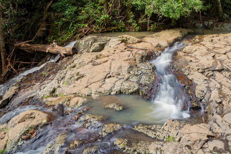 |
The trail descends into a gully, which gradually transforms into a lively stream, with several small channels merging together. A well-constructed boardwalk guides me through this lush environment, leading to a viewing platform that offers a stunning overlook of Greene’s Falls. Here the headwaters of the South Pine River begins its cascading descent into the valley below. This river will journey onwards, eventually flowing into Moreton Bay.
|
 |
From Greene’s Falls, I retrace my steps along the track, diverting through the Cyprus and Rainforest Circuits within the Maiala Reserve. This area, once bustling with the activity of a sawmill in the 1860s, has a rich history. In 1930, it was designated as the first national park in the region, originally named Mt D’Aguilar National Park. Over the years, additional national and forest parks were established, culminating in 2009 when Brisbane Forest Park and Mount Mee Forest Reserve merged to form the expansive D’Aguilar National Park.
|
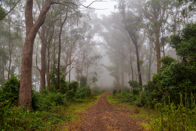 |
From Maiala, I follow Mount Glorious Road, winding along the top of the range through the upper part of the quaint village. The atmosphere is serene, with the early morning mist beginning to descend, enshrouding the forest in a thick, ethereal veil. Turning off onto Lawton Road firebreak, I start my descent down Northbrook Ridge. The path is steep and challenging, but the beauty of the mist-laden forest is captivating. The track crosses the very steep side of the hill, skirting the rocky outcrops of Northbrook Mountain. The mist adds a mystical quality to the landscape. |
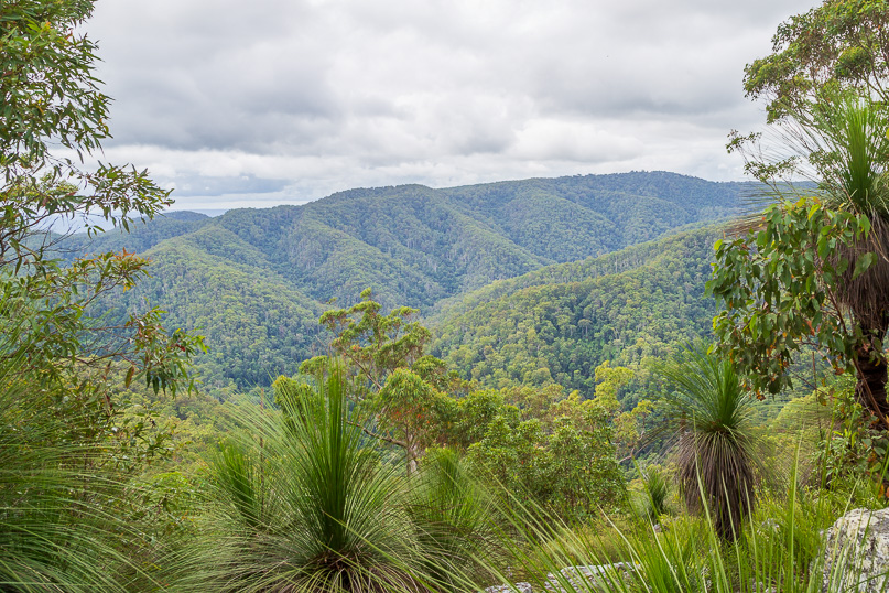 |
A side track beckons me up the ridge towards the summit of Northbrook Mountain. The path is narrow and somewhat overgrown. Standing atop the rocky outcrop, I have a clear, panoramic vista across the range. The ridges stretch out concealing the very paths I will be following over the next few days. Just across the valley lies the ridge I will be tackling tomorrow after crossing Northbrook Creek.
|
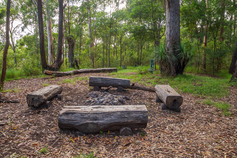 |
Continuing a couple of hundred metres down the ridge from the summit, I reach Northbrook Mountain Remote Camp. Here I set up my tent. Unlike the previous two camps, this one lacks a shelter, but the calm, overcast night brings no wind or rain, making it a peaceful place to rest.
|
|
