Introduction to today's journey
Today's journey initially follows the Noosa River downstream before starting a long climb back up to the top of the Cooloola Sandmass. Upon reaching the top, the track continues through the forest before reaching the enormous Cooloola Sandblow. Descending the long sandblow I re-enter the scrubby forest near its bottom and start another long ascent. Eventually I reach the narrow ridge of the top of the range and follow it as the forest thins before clearing into open heathland. Here I follow the track down the descending range with a clear view of Noosa in the distance. The track re-enters the forest before crossing a small sand blow then passes through more scrubby forest around the ridge until reaching Brahminy Walker's Camp exposed on the top of the range.
Distance hiked today: 19.8km
Total distance hiked: 688.5km
Today's Journey
 |
The morning dawns overcast. After packing up the camp I follow the track heading downstream through the everglade forest beside the mirror smooth Noosa River. |
 |
After two kilometres the track leaves the river crossing a short plain before starting a long ascent on the soft white sand back to the top of the sandmass range. |
 |
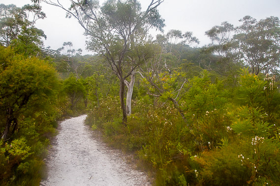
Upon reaching the top of the range at just over 200 metres above sea level, the track winds its way through scrubby forest along the fairly level ridge line passing a lot of wildflowers. |
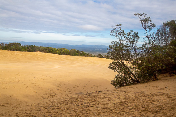 |
The forest suddenly ends at the impressive Cooloola Sandblow. From here there are views across the Noosa Everglade to the hills beyond. From here I turn left to follow the route across the golden desert sand. |
 |
The route descends the sandblow, passing a distinctive dead tree on this otherwise barren area of sand. The track restarts about a kilometre away in the forest in the centre of the image just to the right of the yellow patch. The sea is visible at the end of the valley. |
 |
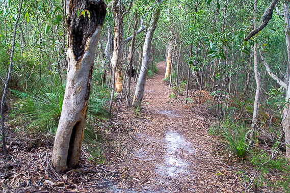
Upon re-entering the bush, it is initially scrubby but there is a small section of schlerophyll forest at the bottom of a gully, the last patch of rainforest along the sandmass. It does not last long though with the forest becoming scrubby again as the track rises out of the gully. |
 |
The track winds its way back to the top of the range. The going is slow with the sand through here being quite soft. The scrubby trees are just a little too high to afford any views of the sea to the left or the Noosa Everglade to the right. |
 |
Eventually I reach a point where the scrub suddenly clears into low heathland scrub. Here I have views over the sea and down to the Noosa Headlands and Mount Coolum in the distance. From here the range begins to drop as I'm approaching its southern end. The track snakes its way down the top of the ridge before heading around a hill. |
 |
Under the hill I cross a small sandblow of soft sand before returning into scrubby forest to continue walking around the hill eventually reaching the exposed Brahminy Walkers' Camp. |
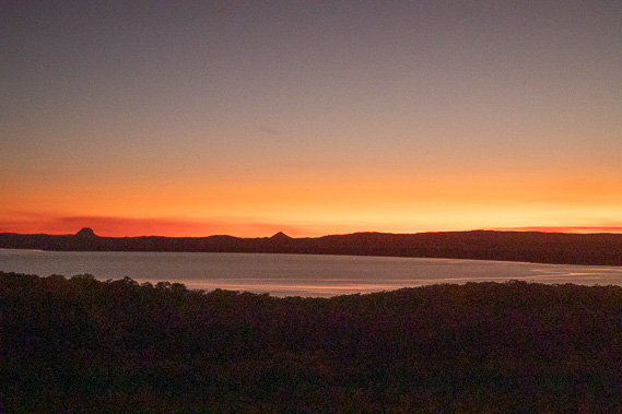 |
After setting up camp, I watch the sunset over Lake Cootharaba. The inland route crossed the tops of some of the ranges on the other side of the lake before reaching the Fig Tree Point camping ground at the right hand side. It is fascinating to see the same view looking from the other direction over the rolling ranges and sharp volcanic plugs lining the skyline. |
|
