Introduction to today's journey
Today's journey captures the sunrise over the Pumicestone Passage before I cross the Bribie Island Bridge to Sandstone Point. From here I hike along the coast through the mangroves to Beachmere, heading through the town to Moreton Terrace Park from where I reach the mouth of the Cabooture River before returning to the Beachmere town for the night.
Distance hiked today: 24.3km
Total distance hiked: 920.9km
Today's Journey
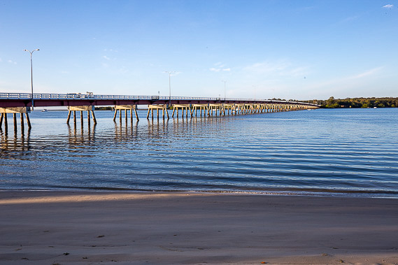 |
After watching the dawn beside the calm waters of Pumicestone Passage, I cross the somewhat rickety bridge back onto the mainland. |
 |
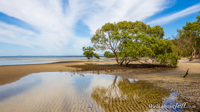
Once on the mainland I head to Sandstone Point following the narrow coast between the dramatic sandstone bluffs and the row of mangroves marking the start of some extensive sand flats stretching out over Deception Bay. |
 |
I reach a deep creek, but heading downstream the crossing is completely dry at its mouth from where the tides have pushed sand up blocking its entrance. |
 |
Continuing along this remote section of coast without any path or track to follow, the first I have come across since leaving Rainbow Beach, the tide quickly comes in over the flats. Remains of furniture and other things washed down in last years big floods litters the otherwise pristine beach. |
 |
I pass a few holiday houses at the northern end of Beachmere before returning to the mangroves where I find a large flat and dry area to make quick progress. The tides flood this area depositing salt to form these interesting patterns. |
 |
I find an old dredge washed up at the edge of the mangroves as the tide continues to come in. |
 |
Reaching another creek now flooded by the incoming tide, I follow a rough dry trail upstream to the road to cross it before following another track downstream to meet the the Avicennia Walk which goes through the Beachmere Conservation Area bush before reaching the quiet suburbia of Beachmere. |
 |
From the end of the track there's a few kilometres of walking through the town of Beachmere with the occasional view of the bay at the end of the side streets. The tide is in now and across the front of the town there is no beach beyond the rock wall. |
 |
Upon reaching the southern end of Beachmere, I follow a track through Moreton Terrace Park passing an interesting landscape of mangroves and stumps battling the constantly changing coastline in this area. |
 |
The coast swings around to the mouth of the Caboolture River, where after negotiating a lot of dead and fallen trees from last year's flood, I reach a nice clear area where I watch the sun set behind the D'Aguilar Range before returning to Beachmere for the night. |
|