Introduction to today's journey
Today's journey starts with kayaking across the mouth of the Caboolture River and exploring the Deception Bay Conservation Area before continuing along the coast along Deception Bay and onto the Redcliffe Peninsula where I reach Scarborough Beach for a dramatic sunset.
Distance hiked today: 24.9km
Total distance hiked: 945.8km
Today's Journey
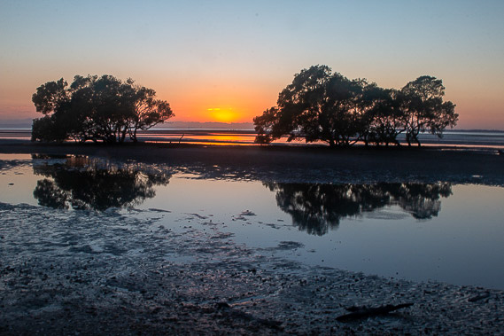 |
Returning to the mangroves of Moreton Terrace, I watch the sun rising over the horizon. The tide is out exposing the mud flats at the mouth of the Caboolture River. |
 |
Once the sun is up, I kayak across the mouth of the Caboolture River. The air and water are both very calm on this still morning. Reaching the jetty on the other side, I start exploring the Deception Bay Conservation Area. |
 |
I reach and follow Burpengary Creek downstream as the tide quickly comes in. I reach this point near the creek's mouth with the Redcliffe Peninsula visible in the distance. |
 |
As the river channels flood, I cross the hardened mud flats in the conservation park and follow a route through the mangroves towards Deception Bay village. |
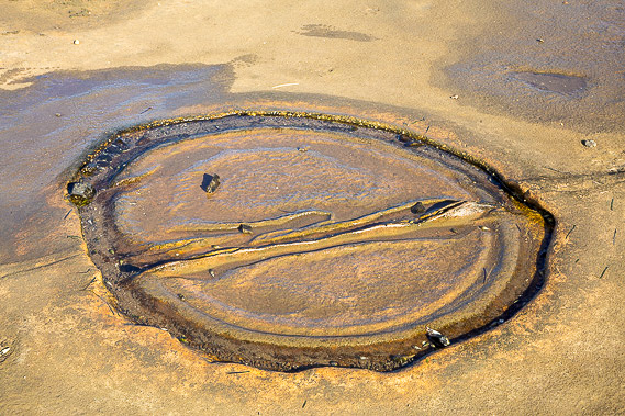 |
At the southern end of Deception Bay Conservation Park, I reach a large flat area of hardened sandstone with these very interesting sandstone formations etched into it. These are all naturally formed but they baffle geologists who can't work out how they formed. |
 |
I continue following the coast southward along the edge of Deception Bay village. The tide has come in covering the sand and mud flats which extend out a long way when the tide is out. |
 |
Upon reaching the end of Deception Bay village, the path heads inland a little way passing through eucaplyt forest alternating with suburbia. |
 |
After a couple of hours I reach the start of the Redcliffe Peninsula, passing more wetland before reaching a large new housing estate at the western end of Scarborough. |
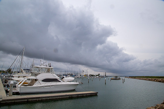 |
After passing some canal estates, I reach Scarborough marina as a thunderstorm passes by. Fortunately it doesn't quite reach this area but the cloud formations are fascinating. |
 |
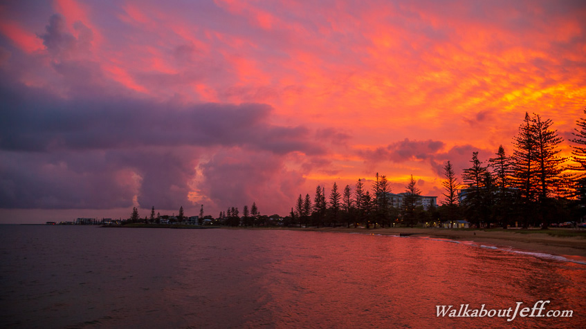
Rounding the top of the point at Scarborough, I reach the red soil formations giving the Redcliffe Peninsula its name. After exploring these dramatic cliffs, I follow the path to the other side of them to Scarborough Resort from where I watch a dramatic sunset. |
|