Introduction to today's journey
Today's journey follows the coast southward from Scarborough Beach passing redcliff to Woody Point, then continuing along the coast into Bramble Bay to the Houghton Highway causeway where I turn to head around Hays Inlet to Kippa Ring Train Station from where I follow the rail trail to Murrumba Downs and head to the edge of the North Pine River.
Distance hiked today: 34.3km
Total distance hiked: 980.1km
Today's Journey
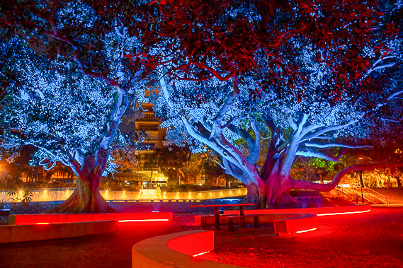 |
Starting at Scarborough Resort just before first light, I look at the interesting lighting on the Gollum Trees, a couple of large Moreton Bay figs. |
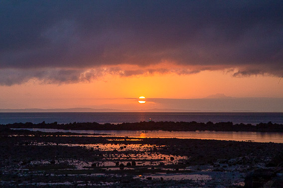 |
I head out to Osbourne Point to watch the colourful sunrise over the sand hills of Moreton Island. The tide is out exposing the rocky reed extending out from the point. |
 |
The clouds quickly clear as I head down the coast to Redcliffe Jetty before diverting into the town centre to explore Beegees Way. |
 |
Continuing along the coast, I follow the boardwalks and paths as the tide comes in. Heading up over Woody Point, I pass the remains of the Gayndah quickly deteroirating on the beach. |
 |
Reaching Woody Point, I head out onto the jetty to look across the bay towards Sandgate and the city, the destination of this circuit now getting ever closer. |
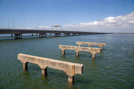 |
Following the bay around Woody Point Beach and Clontarf Beach, I reach the Hornibrook Highway crossing the 2.5 kilometre wide causeway at the mouth of the Pine Rivers. I could walk across the bridge and reach Shorncliffe in a couple of hours, but instead divert inland to explore the Pine Rivers area for a few days. There is a small jetty here at the start of the original bridge across the causeway with a few of the supports remaining. |
 |
From the highway, I head northwards along the edge of Hay's Inlet Conservation Park, exploring the mangroves and mud flats as much as I can before heading through the industrial part of the Redcliffe Peninsula to Kippa Ring Train Station. |
 |
Kippa-Ring Station marks the end of the new Redcliffe Peninsula train line. Running beside the train line is a paved walkway and bikeway heading the length of the railway to Petrie. I follow this pathway through nicely landscaped gardens and brilliantly painted sound boards. |
 |
I follow the path to as far as Murrumba Downs Station where I turn southward passing the Castle Hill Lakes through peaceful suburbia. |
 |
I reach the North Pine River just after sunset from where I watch the dusk over the dark water on this warm evening. |
|
