Introduction to today's journey
Today's journey follows the North Pine River upstream to Young's Crossing where I divert to explore part of Lake Kurwongbah before returning to Young's Crossing and following the walking trails around the shore of Lake Samsonvale to Forgan Cove.
Distance hiked today: 27.9km
Total distance hiked: 1008.0km
Today's Journey
 |
I return to the North Pine River to watch the dawn under overcast skies before heading upstream. |
 |
A boardwalk passes through a mangrove section before heading up the high bank where I follow Dohles Creek Road through Kallangur. |
 |
Upon reaching the railway line, I return to the Petrie to Kippa-Ring Trail which I follow to its end at Petrie Station. |
 |
From Petrie, I cross Gympie Road and follow the tracks upstream along the mangrove flanked North Pine River. |
 |
Eventually I reach above the tidal limit and continue upstream to Young's Crossing. |
 |
From Young's Crossing I divert to the still waters of Lake Kurwongbah. where I relax for lunch before returning to Young's Crossing. |
 |
The forest under Lake Kurwongbah is very thick and lush as I head downstream along Sideling Creek from the dam wall to where the creek meets the North Pine River at Young's Crossing. |
 |
From Young's Crossing, I follow a couple of roads to Lake Samsonvale, the main source of the North Pine River. At this point I have covered exactly a thousand kilometres since departing Wilson Point in Brisbane City 42 days ago. Here I descend to the shore of the lake and follow it around the penisula of Bullocky Rest. |
 |
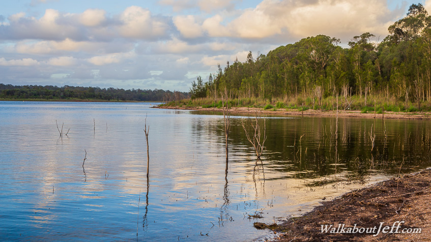
From the end of Bullocky Rest, I follow the walking track around the next group of headlands towards Forgan Cove. Here I am passing a flooded channel from an old stream which would have flowed through here during heavy rain until the dam was built in 1976. |
 |
Approaching Forgan Cove, I watch the sun set behind Mount Samson with the top of the D'Aguilar Range visible further behind. The long dead remains of trees which once grew when the lake level was a lot lower during drought sticks up above the water. |
|